
by Amanda Kahn
First of all, this post is about extra, or supplemental, terrestrial (meaning land-based, not ocean-based) food–not extra-terrestrial food, which is material for other blogs.
The Strait of Georgia lies between Vancouver Island, where Bamfield is (on its west coast), and mainland British Columbia. It is a major waterway for ships and is heavily influenced and used by humans through recreation, diving, boating, tide-pooling, discharges, etc., but it’s also a food- and nutrient-rich habitat for all sorts of animals. It gets a near-equal input of carbon (a measure of food since carbon is necessary for all living things) from ocean-driven plankton blooms as from land-based sources (Johannessen et al. 2003). I took some photos of one of the major sources of land-based carbon on a recent flight back to Edmonton from Bamfield.

Looking out from Vancouver Island toward the mainland, two light-colored plumes in the water indicate something different about the water there. Indeed, these colors arise from sediment and plankton blooms in water coming from the land. In the top right is a large plume that extended far beyond this photo. It comes from the Fraser River. Credit: A Kahn 2013
In the picture above, you can see different colors in the water. The colors result from suspended sediments and blooms of plankton arising from the water’s interactions with land. Everywhere near the coast gets inputs from land, whether from rocks, sediments, and sand right along the coast becoming suspended or dissolved in the water or from rivers flowing in with suspended sediments, nutrients, phytoplankton, and bacteria from farther inland. The Fraser River is the largest source of freshwater and sediments to the Strait of Georgia–up to 73% of the freshwater and 64% of particles (Johannessen et al. 2003). It is responsible for the plume filling much of the strait, in the upper right of the photo above. Near land, there can also be mixing, as shown in the bottom left of the photo above and zoomed in on the photo below.

Looking south, the Fraser River plume (left) and the mixing near islands near Vancouver Island (right) create different-colored plumes of water. Credit: A Kahn 2013
So why does the Fraser River plume extend so much farther than the non-river areas? While part of it involves the obvious water movement of rivers, there’s plenty of wave action on coastlines. It’s related to something I mentioned before–that the Fraser River is the source of 73% of the freshwater coming into the Strait of Georgia. Fresh water is less dense than salt water so it floats on the surface. Its different density also means it doesn’t mix very well with seawater so it ends up spreading out along the surface of the water. If you put an instrument in the water that measures salinity, such as a CTD (Conductivity, Temperature, and Depth sensor), you’ll see a drop in salinity from the river.

The salinity drops considerably within the plume, indicative of the freshwater coming in from the Fraser River. Credit: Ocean Networks Canada, via Flickr.
The water that comes in with the Fraser River is full of suspended sediments and plankton, turning the water a different color. If you look out on the Strait of Georgia from land during spring and early summer, the peak of the “freshet” (when snowmelt swells the Fraser River and creates the strongest plume), you’ll see water that is green or murky brown relative to more oceanic water. Sediments from the river settle slowly but bring in with them macronutrients (especially silica; Treguer et al. 2013) and micronutrients such as iron–both of which are needed for plankton to grow. As plankton grow, they turn the water’s color from deep blue to a brown, green, or milky blue, depending on the dominant plankton types.

Water color changes dramatically near the edge of the Fraser River plume. Credit: Kevin Bartlett; via Ocean Networks Canada and Flickr
As plankton grow, they form the basis of a food web for grazers and predators. These terrestrial inputs of food are a big reason why coastal areas have higher concentrations of plankton, and as a result higher numbers and diversity of animals, compared to open ocean areas. To learn more about research on the Fraser River plume, check out this post from Ocean Networks Canada.
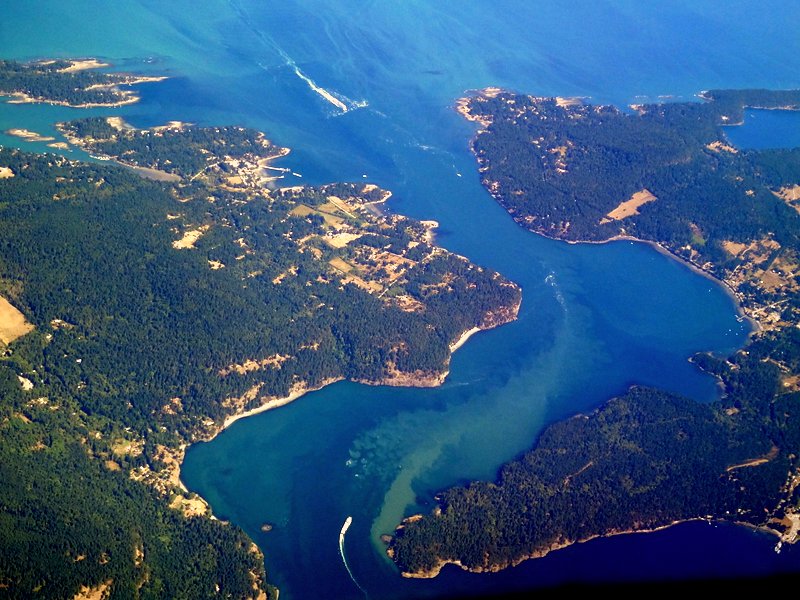
Active Pass. Credit: A Kahn 2013
References
Johannessen, S. ., R. . Macdonald, and D. . Paton. 2003. A sediment and organic carbon budget for the greater Strait of Georgia. Estuarine, Coastal and Shelf Science 56:845–860.
Tréguer, P. J., and C. L. De La Rocha. 2013. The World Ocean Silica Cycle. Annual Review of Marine Science 5:477–501.

